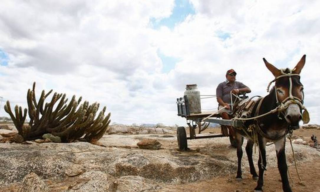
RIO – Within a country praised all over the world for its economic development, there is another Brazil, still untouched by progress and highly affected by a chronic issue which keeps only getting worse–the drought. The Caatinga nation, comprised of 1482 municipalities stretching across 1.3 million km², is suffering the harshest drought of the last 30 years. In the state of Bahia alone, more than 214 towns have declared state of emergency. The rivers are so dry that all that remains in their beds is fine sand.
This extreme event will surely come to an end, but soon it may be followed by another one. And, between one drought and the next, the agricultural production collapses–a phenomenon exacerbated by global climate changes.
The Intergovernmental Panel for Climate Change (IPCC) projections declared the Caatinga the most fragile biome in Brazil. In fact, it is the largest area in the world vulnerable to desertification. In some areas of Pernambuco state, the average temperature has already increased 3 degrees Celsius since 1960. And if you take the whole of the Northeast region, thermometers have been showing an extra1.5 degrees Celsius, on average, in the same period.
—A biome needs a minimum of 50% of its original coverage to be able to regenerate. The Caatinga has only 45%— alerts Eduardo Assad, a researcher with Empraba Informática Agropecuária, a thematic research unit of the Brazilian Agricultural Research Corporation. —Therefore, the chances for desertification are very high, and there is no coordinated effort to save the region.
According to Embrapa, during the next decades the Northeast region of Brazil will see a sharp fall in the production of corn, rice, beans, cotton, sunflower and manioc. These crops can survive at the narrow coastal plains known as Zona da Mata, where there is groundwater to sustain them, but not in the hinterlands. According to Assad, there are still plans in the semiarid region for projects that “deal with the drought”, like mango and jackfruit orchards, but even those are lacking resources and information outreach.
—Although the project is more than 30 years-old, it is very difficult to implement it as the farmers keep on trying the beans and the corn. But the truth is the climate is not good for these crops any longer, explains the researcher.
Meteorological changes during the growing season are responsible for an average of 80% of the variation in agricultural output. In the semiarid region, the wet period, during which farmers are preparing the soil, sowing and irrigating, is getting ever shorter. In some areas, it lasts less then 3 months.
The subsistence farming is suffering the most in this context because these farmers have less resources to adapt, as well as less water supply. And because they are not receiving much needed information, the inhabitants of the semiarid can actually further aggravate the global process of desertification by choosing to raise cattle and other irregular ways to use the land, which in turn makes the biome even more vulnerable.
—There is a tremendous lack of education—says Javier Tomasella, research coordinator at the CEMADEN, the national Center for Natural Disaster Monitoring and Alert.—The family farming in the semi-arid is a specific case of that. The government is supposed to bring the information directly to these producers and not expect them to come looking for it. In many instances, the data already exists in the form of scientific research, but it has not been delivered to the interested parties. With the right information at hand, small properties can unite and form medium-size cooperatives that can become profitable. This should be the solution for those who depend on this biome.
Tomasella added that with adequate water connections there will be quality economic production. It will evolve, but there is still some “redistribution problems.”
—Surely, these programs are still below our expectations, he said, but managing them requires major investment. One cubic meter of water weighs a ton; imagine how much it costs to move it around!
Last month, CEMADEN hosted an event in Fortaleza, the state capital of Ceará, with the goal of finding solutions to save the Caatinga from agricultural collapse. It is important, however, to define the concept of desertification. Several european countries used to dealing with dryness—Italy, Greece and Spain, for example— have developed a single criterium for detecting the threat of drought. But in the Brazilian Northeast, each city or state collects its own information, there is no exchange within neighboring areas.
The lack of communication among close municipalities only reflects, in part, the disregard the biome has received for decades by the state, which has barred the access for scientific institutions to the few existing data on climate.
—The Northeast has a considerable amount of data on rain fall but for a long time, especially during the period of military dictatorship, parts of the meteorological indices were considered national security information, therefore inaccessible for research—complains Paulo Cesar Sentelhas, professor of Agrometereology at Universidade de São Paulo (USP) —And the bottom line is: we got stuck for 40 years; we could not generate technology. The pluviometric studies are insufficient by themselves if not seen together with other data, like the relative humidity, for example.
If we take in consideration the large size of the semiarid region, meteorological networks are also scarce there. Even where there are meteorological stations, they are not well maintained. And because there are no historical series—either due to only recently installed points of study, or because the information is still kept “locked away”—the research on agrometeorology is still incomplete.
While new information is being gathered, the CEMADEN and other institutions are striving to create a single index to define what desertification really is. This will be the base for a diagnostic of the situation of the overall Northeast region of Brazil. It will then be possible to update and improve on it. For example, there is already a map delineating changes in the landscape and vegetation in the last decade. It may come as a short period, in terms of scientific research, but it's a good starting point considering how threatened this biome is.
Last month, the United Nations organized a “Desertification Week”. The initiative aimed to raise awareness to desertification and land degradation, and to give it center stage at the Rio+20 debates.
There is great concern over the environment and the populations in biomes such as the Caatinga, as well as what it represents in terms of capital loss. Extreme weather events are responsible for a global loss of US$ 41.3 billion. Among the causes of agricultural collapses worldwide are flooding, responsible for more than half of the crop loss, winds (30%) and drought (10%).
In Brazil, though, it is the drought that drives most of the losses in the fields. According to Sentelhas, all areas producing fibers, energy and food in the country are drought-prone but the semiarid deserves special attention, which justifies the concerns raised by CEMADEN. If the integrity of the biome cannot be guaranteed, not only the food production is under great risk but also the stability of the 30 million inhabitants of the Caatinga. If they can't make a living, they may well end up leaving the region, triggering a chaotic process of urbanization.
Desertification is caused by a variety of factors in addition to the weather. Some can be avoided by a change in farming methods.
—Too much irrigation can be detrimental to the semiarid, says Sentelhas.—The water reaches the crop
with a concentration of salt. When the water evaporates the salt stays unless rain falls and moves it away. If that doesn't happen and the salt remains, the area may become barren.
According to the professor, it is important to create a surveillance system to avoid an agricultural collapse, a system that can respond to the specific needs of each region. It should be a multidisciplinary effort encompassing specialists from the areas of meteorology to agronomy, among others.
—Production costs as well as land prices are ever so higher, reminds Sentelhas.—Corporations are always looking to increase efficiency. This is a great opportunity to integrate economic efficiency and sustainable development.
English version: Frida Sterenberg